Elton Nguyen*, Taemin Heo^, Lance Manuel+
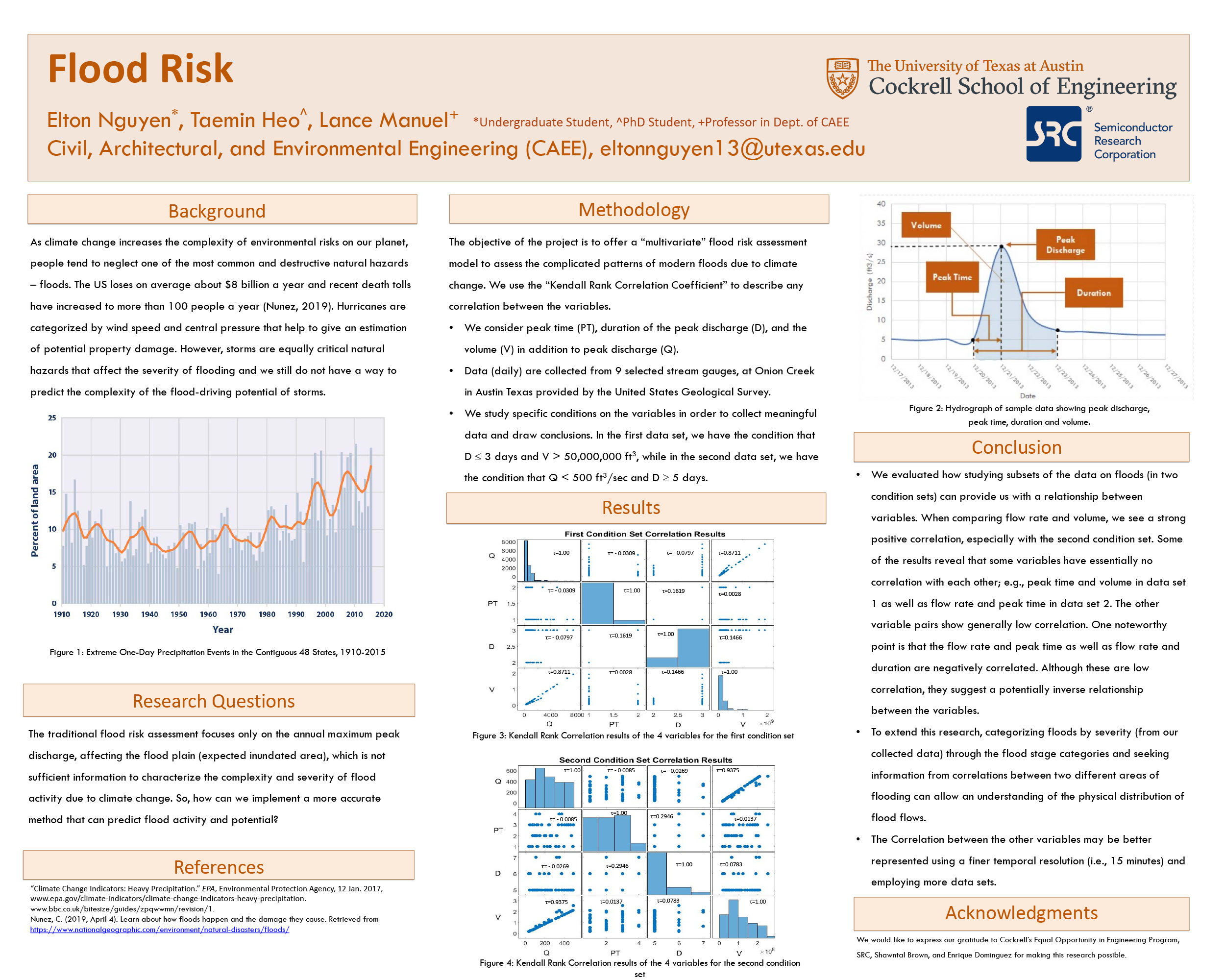
Increasing exposure and climate change have resulted in more severe and complex flood damage and risk. Hurricanes have been categorized by its observed wind speed and central pressure to give an estimation of potential property damage. However, even though storms are also a critical natural hazard that affect the severity of flooding, we still have not found how to predict the complexity of flood driving potential of storms. The traditional flood risk assessment focuses only on the annual maximum peak discharge, affecting the flood plain (expected inundated area), which is not sufficient enough to account for the complexity and severity of flood activity due to climate change. In order to consider the complicated patterns of modern flood risk, we need to consider a “multivariate” flood risk assessment model that will consist of peak time, duration of peak discharge, and volume in addition to peak discharge. With these variables, we can set conditions that will allow us to observe events that are potentially harmful. The flood features will be collected from 9 selected stream gauges at Onion Creek in Austin, Texas provided by the United States Geological Survey. With the collected data sets, we will use Kendall’s Tau Correlation, a non-parametric statistical tool, that allows us to evaluate the relationship of our variables. Kendall’s Tau Correlation Coefficient works by ranking the variables from least to greatest, finding the concordant (how many variables below are greater than the variable we are evaluating) and discordant (how many variables above in ranks are less than the variable we are evaluating) pairs, and the results come from subtracting the two pairs divided by the addition of the two pairs. The results reveal that some have a strong correlation, low correlation, and no correlation.

Comments
Great poster — thank you for sharing your research! This work seems like it will only become more relevant as we continue to see the effects of climate change. —Jeanette Herman
Good job! What are some potential outcomes if governments/other groups were to adopt this type of model? —Rob Reichle
Hi Rob! Thank you so much for the comment. I think if the government/other groups were to adopt this type of model, they would be able to combat the damages of future flooding much better. The current model only focuses on the annual maximum peak discharge, which is only one point per year. This only accounts for the most extreme event throughout the entire year. Our model allows them to see all extreme flood events with varying magnitudes. With that information, they can flood events using by using the flood stage categories, which is currently only a qualitative description of flood severity. I hope this answers your question! —Elton Nguyen

